This is the equivalent to Level 4 SCQF, 2 SCQF credit points and can be run on a ratio of 1:8 people.
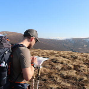
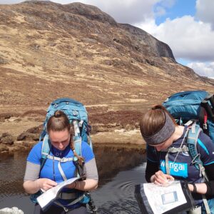
- Navigate using a variety of maps and scales.
- Use 4 and 6 figure grid references with worded descriptions to define the position of a map feature and to locate a feature on the ground.
- Orientate the map using handrails, obvious point features and major landforms.
- Use linear features (e.g. paths, tracks, clear boundaries) as handrails in simple navigation exercises.
- Relate prominent landforms such as large hills and valleys to corresponding contour information on the map.
- Orientate the map by aligning a compass needle against grid north and be aware that magnetic variation causes an inaccuracy.
- Use an orientated map to confirm the direction of travel.
- Use clearly identifiable features to confirm position along the route and to recognise when the target has been overshot.
- Measure horizontal distance on the map and estimate distance on the ground using timing, pacing and simple visual judgements e.g.100m.
- Plan and implement simple routes and navigation strategies based on the above skills.
- Recognise a navigation error within a few minutes and apply simple relocation techniques using handrails and prominent features.
- Be aware of the use of mobile phone location apps as a back up to map and compass and in emergencies.
- Demonstrate an awareness of local and national access issues, access legislation, personal responsibilities, the Countryside Code and sustainability.
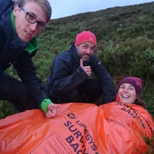
- Demonstrate appropriate knowledge of walking equipment, safety equipment and emergency procedures.
This is the equivalent to Level 5 SCQF, 2 SCQF credit points and can be run on a ratio of 1:8 people.
- Utilise the skills and techniques of the Bronze Award in the context of Silver Award navigation strategies.
- Relate small hills, small valleys, prominent re-entrants and prominent spurs to their corresponding map contours. Use prominent hills, ridges, spurs and valleys as a means of navigation in good visibility.
- Use landforms and point features to orientate the map and as collecting and catching features.
- Use a compass to: Accurately follow a bearing; aim off; check the direction of handrails and other linear features.
- Deviate briefly from a compass bearing to avoid obstacles or difficult terrain and accurately regain the original line.
- Use back bearings to check route following accuracy.
- Measure distance on the ground in varied, open terrain using timing and pacing and make practical allowances for any discrepancies.
- Simplify legs using coarse navigation, attack points and fine navigation.
- Recognise dangerous or difficult terrain on map and ground.
- Plan and implement navigational strategies based on the above skills.
- Maintain route finding accuracy in poor visibility or darkness.
- Recognise a navigation error within a few minutes and apply appropriate relocation techniques.
- Understand how personal fitness and nature of terrain affect route choice both at the planning stage and on the ground.
- Understand the potential consequences of fatigue and physical discomfort in demanding terrain and/or extreme weather conditions.
- Select appropriate clothing, equipment and first aid items for walking in open country in all weather conditions.
- Demonstrate an understanding of the Countryside Code, current access legislation and the environmental impact of walkers on the countryside.
- Understand the responsibilities of walkers towards other countryside interests such as farming, forestry and conservation.
- Understand how outdoor activities impact on the environment and how that impact can be minimised and sustainable use promoted.
This is the equivalent to Level 6 SCQF, 2 SCQF credit points and can be run on a ratio of 1:4 people.
This will be available from Summer 2023 so check back or drop us an enquiry if you are interested!
- Utilise the skills and techniques of the Bronze and Silver Awards in the context of Gold National Navigation Award navigation strategies.
- Utilise contours and fine detail as the prime method of navigation.
- Accurately: Follow a route, judge distance, check progress against time, use relevant compass skills and maintain continuous map contact.
- Use back bearings and transits to confirm the current position.
- Use aspect of slope as an aid to relocation.
- Select appropriate techniques within an overall navigation strategy.
- Navigate in intricate terrain in reduced visibility i.e. mist or darkness.
- Select an appropriate, safe route in relation to height gain and loss, dangerous terrain and other major hazards.
- Assess the route ahead in the field in relation to prevailing conditions or changing circumstances (e.g. weather, time, daylight, ability/fitness) and re-plan the route appropriately if necessary.
- Shorten a route, use an escape route and know emergency procedures.
- Recognise the occurrence of a navigational error within a few minutes and apply appropriate relocation techniques.
- Select appropriate clothing, equipment and first aid for walking in remote areas in all weather conditions.
- Understand the physical demands created by hill and moorland terrain in all weather conditions.
- Understand the effects of cold, heat, fatigue and discomfort on decision making and execution of a selected route.
- Understand the implications of climate change on the outdoor environment and be knowledgeable in practical steps to mitigate its effect.
- Understand the pros and cons of appropriate electronic navigation devices and describe/demonstrate their use in the context of Gold terrain.